


Details and routes
From this page you can access route descriptions, maps, downloadable GPX files, how to get to the start and other details of the event
All the details of the event are included in the two "Word" documents which can be downloaded by clicking the appropriate link, below. These documents contain all you need to know about joining the challenge hikes, including overview of how to get to Peaslake, contact phone numbers on the day, and detailed route descriptions.
NOTE: Both the longer and the shorter routes are slightly different to 2015, so please download the details and read them carefully.
Start time
Both events start from Peaslake Memorial Hall
The start times are:
16 mile event: from 08.30 (walkers only)
27 mile event: from 08.30 (walkers)
27 mile event: 10.00 (runners)
Getting to Peaslake
Peaslake is in Surrey, to the south west of Dorking.
Accessing Peaslake by rail
This year, the event is again being run on a Saturday, to make rail access easier. The nearest rail stations with frequent trains are Dorking and Guildford.
If you're planning on coming by train, the best trains to take are:
- 06.45 Waterloo arr Guildford 07.23 via Clapham Junction
- 07.15 Waterloo arr Guildford 07.51 via Clapham Junction
- 07.33 Waterloo arr Guildford 08.03 via Clapham Junction
- 08.00 Waterloo arr Guildford 08.33 via Clapham Junction
- 07.17 Victoria arr Dorking 08.11 via Clapham Junction. Wimbledon, Epsom, etc
- 07.39 Victoria arr Dorking Deepdene 08.26 via Redhill & Reigate
Trains correct as at May 2016 - please check closer to the date in case of timetable alternations
If you want transport from these stations you must let the Organiser know: he may ask you to take a particular train to facilitate this.
Accessing Peaslake by road:
If you're coming by road, follow the maps at they foot of this page
Route descriptions
Details of the 16 mile event (NOTE: Updated with final version 26 September 2016)
Click here: 16_FOUNDERS_2016_Final.docx to download the details
Details of the 27 mile event (NOTE: Updated with final version 26 September 2016)
Click here: 27m_Founders_2016_Final.docx to download the details
(NB - email london.walks@ldwa.org.uk if for any reason you have problems reading .docx files)
Maps
Maps of the FINAL 2016 16 and 27 mile routes can be viewed on a variety of different open mapping types by clicking here
(Note - the default is Google Earth - select "OpenTopoMap" from the menu at the top right of the screen that appears when you click the link, for an OS-like map)
(Note - on the maps, both options are travelled clockwise and start / finish at Peaslake)
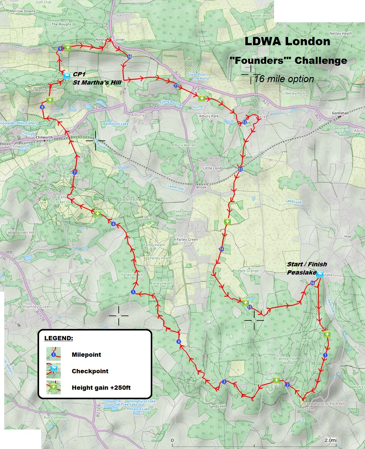
PDF version of the 2016 16 mile option (open streetmap - copyright problems prevent publication of printable OS maps here):
View here: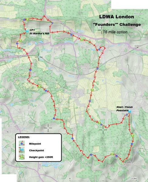
You can download and print the map as a full sized PDF file (0.8MB) here:
Founders_challenge_2016_16_mile_map.jpg
(NB if the image opens straight away when you click on this link, just right-click and select "save as")
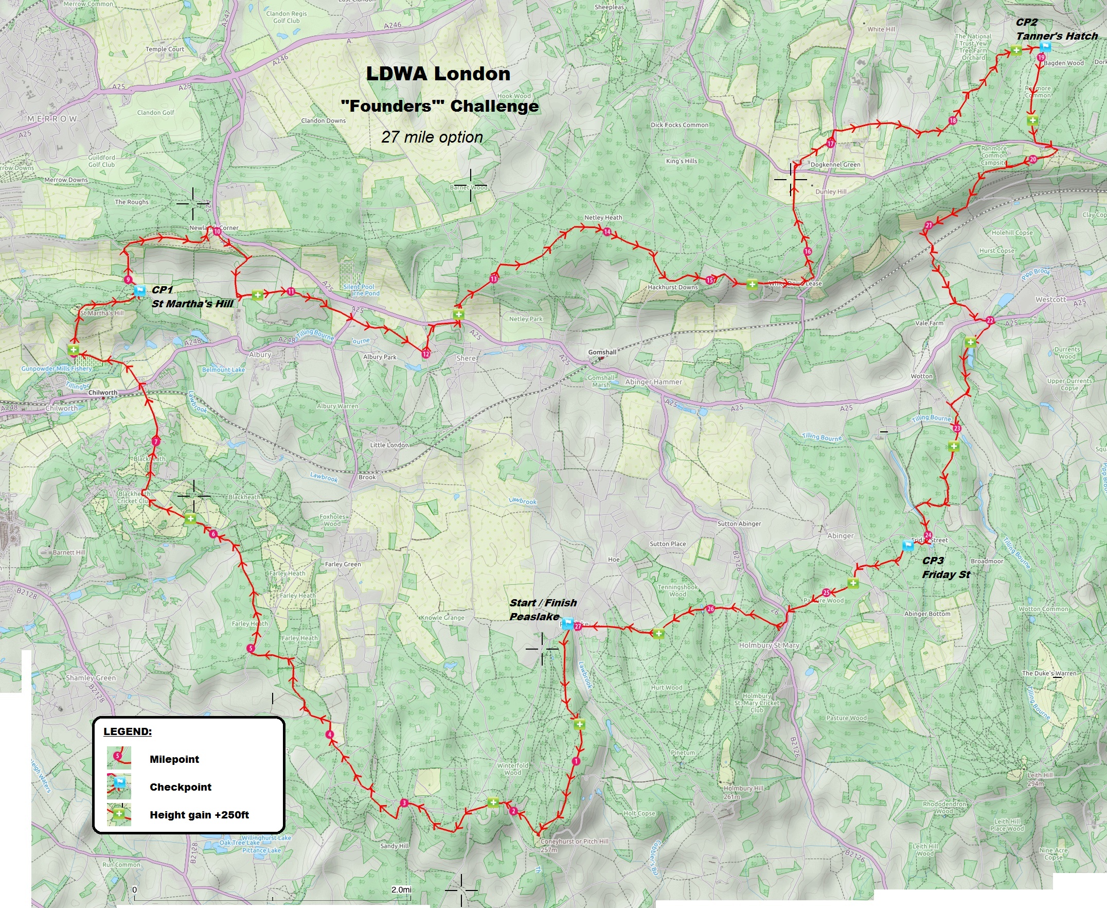
PDF version of the 2016 27 mile option (open streetmap - copyright problems prevent publication of printable OS maps here):
View here: 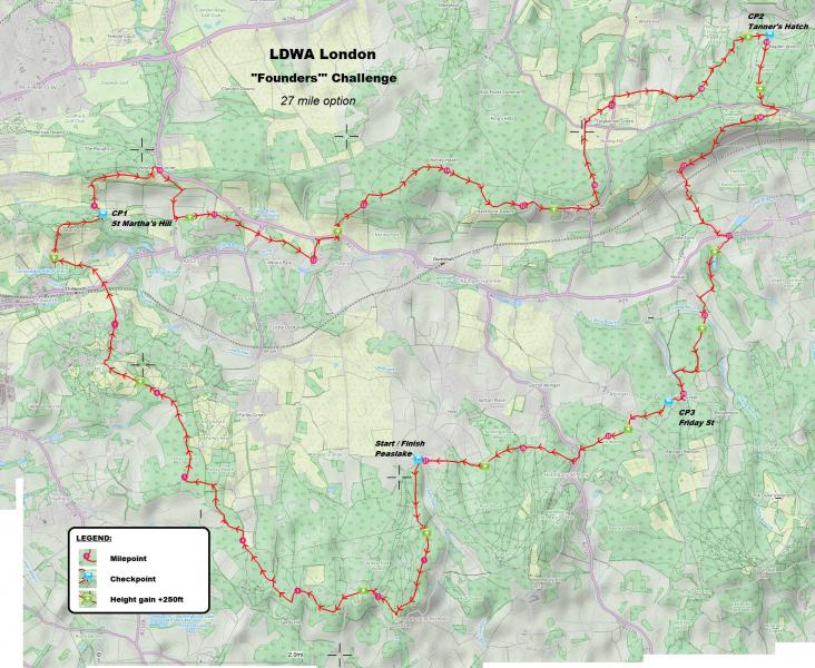
You can download and print the map as a full sized PDF file (2.7MB) here:
Founders_challenge_2016_27_mile_map.jpg
(NB if the image opens straight away when you click on this link, just right-click and select "save as")
Downloadable GPX files
GPX files of the final routes for 2016 are attached below and are available for download
Please Note: There will be some changes in 2016 to both the longer and shorter routes:
- There are Route and Track files. Some GPX devices will only accept Track files; the Route files cover the same ground but have additional information (see next point) added to the waypoints, which may assist navigation. The track files are exactly as recorded on recces of the 16 and 27 mile options in August and September 2016, showing almost every footstep (with a few minor errors corrected). There are also fewer waypoints in the Route files than the Track files.
- Additional information has been added to each route point in the Route files, which you should be able to read on your GPS device. The information is in the form: miles from start (miles left to end), ft ascended from start (ft to end); current altitude in ft. If you require a GPX file with the routepoint data in metric units, please email founderschallenge@ldwa.org.uk But note both imperial and metric routes are exactly the same
- If you are using the "Viewranger" app on a smartphone or tablet, you may also see milepoints and some other information displayed on the map along the route
16 mile event: (NOTE: Updated with final versions 14 September 2016)
Finalised ROUTE file: Founders_16_mile_2016_ROUTE.gpx
Finalised TRACK file: Founders_16_mile_2016_TRACK.gpx
27 mile event: (NOTE: Updated with final versions 07 September 2016)
Finalised ROUTE file: Founders_27_mile_2016_ROUTE.gpx
Finalised TRACK file: Founders_27_mile_2016_TRACK.gpx
Access maps:
Outline overview map: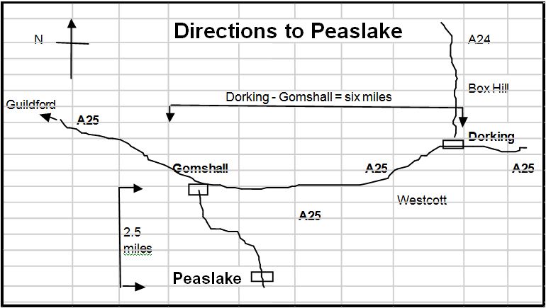
Detailed overview map: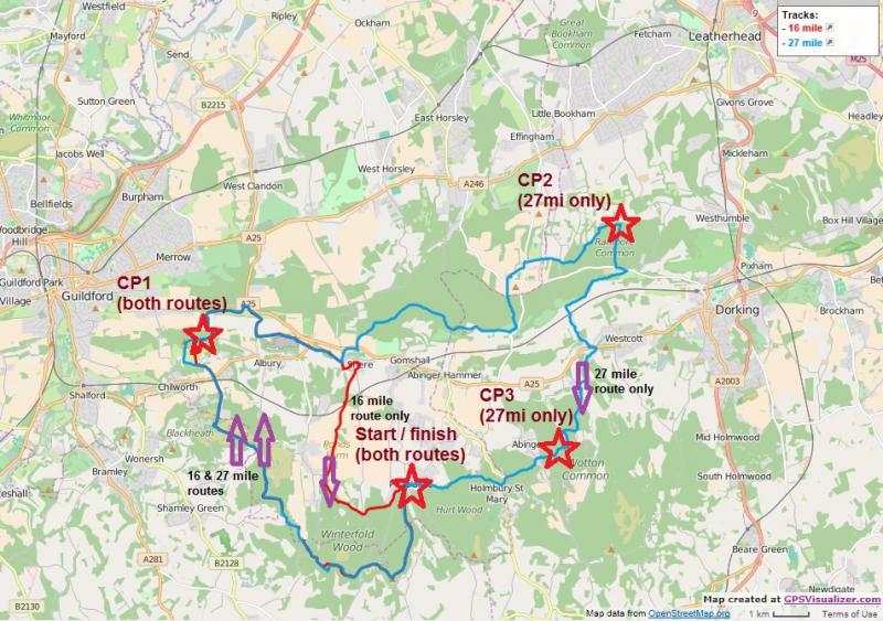
Find out more
Just click the the appropriate links below to find out about:
- Background to the Founders' challenge
- Go back to the Founders' overview page
- Entry fees, in advance, on-the-day, for members and non-members; and what you get in return
- How to sign up, and a link to the "SI Entries" system
- How to volunteer to help
- Contacting us for more information
- Results and report - to be published shortly after the event


