Founders Footpaths
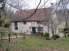  The first official meeting of LDWA members took place here in January 1973 The first official meeting of LDWA members took place here in January 1973 |
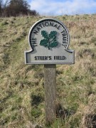
Steer's field - the traditional start & end point of the Founders Footpaths walk |
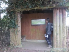
The old bus stop at Ranmore adjacent to Steer's Field - renovated in the early 80's by Surrey Group members but declared unsafe and sadly demolished in 2015 |
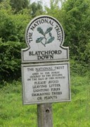
Blatchford Down - visited by the Founders Footpaths |
 |
|
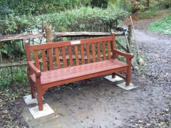
The memorial seat in memory of Alan Blatchford outside Tanners Hatch YH |
||||
|
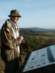
Tony Youngs, who devised the route, seen here on Boxing Day 2001 looking out towards the distant South Downs from the Pitch Hill toposcope erected in memory of Founder Members Alan Blatchford & Chris Steer. |
The 26 mile Founders Footpaths, originally devised by Tony Youngs, and first walked in April 1995 by members of the LDWA Surrey Group. The route affords superb views from the North Downs to the Greensand hills and visa-versa. It follows some of the most attractive paths in Surrey and visits locations special in the history of the LDWA including the old Post Office in Peaslake where it all began (now the cycle hire shop), Blatchford Down, Steer's Field, Tanners Hatch YH and Pitch Hill. The route is used as a basis for the LDWA London Group's annual Founders Challenge which takes place in October. Under the recordership of Elton Ellis the Founders Footpaths is offered as an anytime challenge as detailed below. The route follows mainly rights of way but in places it takes paths that are not shown as rights of way on Ordnance Survey maps but which are on open access land belonging to the National Trust or Hurtwood Control. The route is covered by Landranger sheets 186 & 187 and Explorer sheets 145 & 146. You will need a compass and all bearings in the route description are given as magnetic. The route description is checked periodicaly, but please bear in mind that stiles, gates, barriers, notices, waymarks and even woodlands can appear and disappear over time. The current edition of the route description was last updated in September 2014. You can also download a GPX file of this route. The route is circular and can be started and finished anywhere but the route description starts and finishes at Ranmore East Car Park GR TQ141504 (Steer's Field). Tony produced an informative sketch map of the route which is broadly followed by the current route description with only minor differences. Sketch maps were a hallmark of Tony's routes and this for the Founders Footpaths is typical of them. If you complete the walk in 10 hours or less and would like a certificate, please write a very brief account of your walk, saying where and when you started and finished and making any comments you may have on any aspect of the challenge, and send it with a cheque for £2, made payable LDWA Surrey Group, to the Recorder: Elton Ellis, 3 Charlotte Rd, Barnes, London SW13 9QJ. Your comments on the route description and your help in keeping it up to date would be most welcome. If you have any pictures of your own and would like us to include them in the gallery for others to view please email them to us indicating when and where they were taken. Take your time, linger over the views and most of all enjoy the walk... |
|||
