
| Path Type: | Other Paths |
| Attributes: |
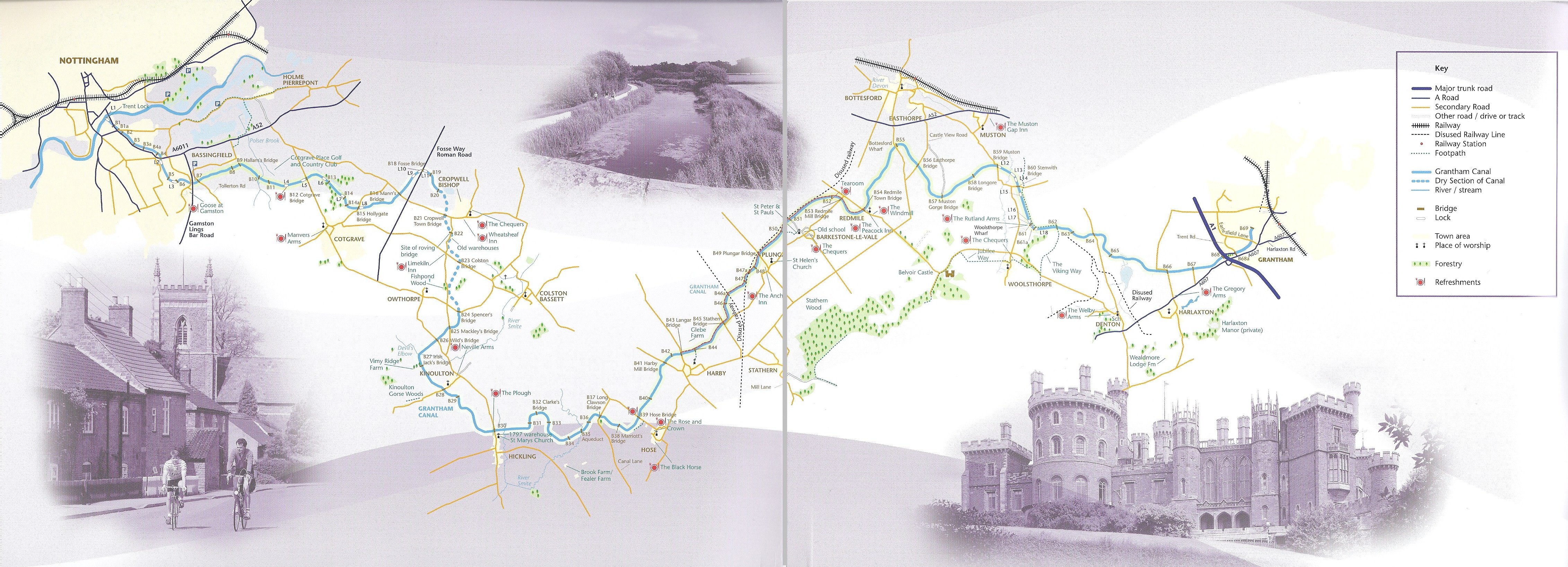
Easy Canal |
| Start: |
SK584386 -
Nottingham, Nottinghamshire
|
| Finish: |
SK905350 -
Grantham, Lincolnshire
|
| Web Sites: | Grantham Canal Grantham Canal - Map Saleby Jogging Centre - Grantham Canal [blog] |
| Guidebook | Romantic Canal alongside the Grantham (Grantham Canal Society ) |
| General Interest Book | Nottingham, York & the North East: Waterways Guide 6 (Collins Nicholson Waterways Guides) (HarperCollins - 2021 ) |
You can use the interactive controls to zoom in and out and to move around the map, or click on a path or a marker for more info.(interactive map help)
| OS Landranger | 129, 130 |
| OS Landranger Active | 129, 130 |
| OS Explorer | 246, 247, 260 |
| OS Explorer Active | 246, 247, 260 |
Reminder: Material downloaded from this website is for personal use only. Commercial use, reproduction, modification of all content is strictly prohibited without prior approval by the LDWA. Please Contact Us if you have any requests.
