Latest News: Read more


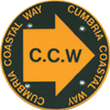
Named posts on green disc: Milnthorpe - CarlisleCumbria Coastal Way

Cumbria, Lancashire

293 km / 182 miles
The route is no longer marked on OS maps and is not endorsed by Cumbria County Council; some permissive paths no longer have access rights so diversions are necessary in places. The route may become superseded by the England Coast Path (ECP) when it is fully open.

From Silverdale on Morecambe Bay, the route follows the fascinating Cumbria coast from the boundary with Lancashire, around the southern Cumbrian peninsulas with their vast stretches of estuarine sands, through the Lake District National Park and the industrial heritage of the west coast, along the Solway Firth and through rough border country with glimpses of Hadrian's Wall and along the River Eden to the historic city of Carlisle, then out on the Eden's other bank to Rockcliffe where the route heads inland to the finish at Metal Bridge.

An infrequent bus service links Metal Bridge with Gretna; alternatively a minor road adjacent to the M6 can be used.

The route links with the Coast to Coast route at St Bees and Hadrian's Wall Path National Trail at Bowness-on-Solway.

The coastal way can be walked in its entirety (10–14 days), or in sections, by people of all ages and abilities. Much of the route-finding is easy, and the route, which rarely climbs higher than 100m above sea level, has been designed to link with public transport.


Details:

Waymark: Named posts on green disc: Milnthorpe - Carlisle
Path Type: Other Paths
Waymark: Named posts on green disc: Milnthorpe - Carlisle
Attributes: Easy
Coastal
Industrial History
Start: SD476751 - Silverdale Station, Lancashire View on StreetMap
Finish: NY356648 - River Esk south bank, Metal Bridge, Cumbria View on StreetMap
Web Sites: Cumbria Coastal Way Visit Cumbria - Cumbria Coastal Way English Lakes - Cumbria Coastal Way

Publications, Badges and Certificates:

Guidebook The Cumbria Coastal Way : Morecambe Bay to the Solway Firth  (Cicerone Press  - 2007 )
Guidebook Cumbria Coastal Way : a walker's guide  (Ellenbank Press  - 1994 )

Maps:

You can use the interactive controls to zoom in and out and to move around the map, or click on a path or a marker for more info.(interactive map help)

Show Connected Path Outlines
National Trails (England & Wales)
Paths Marked on OS mapping
Other Paths
Anytime Challenges

Show Accommodation
Hostel Accommodation
Bunk House
Group Accommodation

Contains Ordnance Survey data © Crown copyright and database right 2016.
© OpenStreetMap contributors under Open Database Licence.
Rights of way data from selected Local Authorities.
Large scale digital mapping is provided by John Thorn.
At high zoom levels the route is indicative only.
Purchase Ordnance Survey Maps (path is named on OS maps):
OS Landranger 85, 89, 96, 97
OS Landranger Active 85, 89, 96, 97
OS Explorer 4, 6, 7, 303, 314, 315, 323
OS Explorer Active 4, 6, 7, 303, 314, 315, 323

Accommodation within 5 km of this Path:


From
Path
Along
Path
Hostel Accommodation
3 km
< 1 km
Bunk House
2 km
24 km
Group Accommodation
1 km
33 km
Group Accommodation
< 1 km
41 km
Bunk House
4 km
62 km
Bunk House
< 1 km
263 km
Hostel Accommodation
< 1 km
276 km
Hostel Accommodation
1 km
276 km

Click to show 6 more Accommodations


Connected Paths:


Downloads:

Reminder: Material downloaded from this website is for personal use only. Commercial use, reproduction, modification of all content is strictly prohibited without prior approval by the LDWA. Please Contact Us if you have any requests.


Route Profile:

309.8 km (192.5 miles)
2,911 m (9,551 ft) ascent
183 m (600 ft)  maximum height

This website uses cookies

To comply with EU Directives we are informing you that our website uses cookies for services such as memberships and Google Analytics.

Your data is completely safe and we do not record any personally identifiable information.

Please click the button to acknowledge and approve our use of cookies during your visit.

Learn more about the Cookie Law