| Path Type: | Paths Marked on OS mapping |
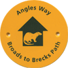
| Waymark: | Yellow disc with name and otter logo in green |
| Attributes: |
Easy Heath Lake/Reservoir/Loch River |
| Start: |
TG519081 -
Vauxhall station, Great Yarmouth, Norfolk
|
| Finish: |
TL955806 -
Knettishall Heath, Suffolk
|
| Web Sites: | Norfolk County Council - Angles Way Norfolk County Council - Angles Way : short and circular walks Griffmonster - Angles Way posts [blog] Annierak - Angles Way [blog] Stephen and Lucy Dawson - Angles Way [blog] Angles Way [YouTube video] |
| External download |
Norfolk County Council - Angles Way : overview map
(Norfolk County Council )
 |
| External download |
Discover Suffolk - Angles Way
(Suffolk County Council - 2005 )
 |
You can use the interactive controls to zoom in and out and to move around the map, or click on a path or a marker for more info.(interactive map help)
| OS Landranger | 134, 144, 156 |
| OS Landranger Active | 134, 144, 156 |
| OS Explorer | 40, 230, 231 |
| OS Explorer Active | 40, 230, 231 |
Reminder: Material downloaded from this website is for personal use only. Commercial use, reproduction, modification of all content is strictly prohibited without prior approval by the LDWA. Please Contact Us if you have any requests.