

2015 03 07 East Cheshire
To the East of Macclesfield(Treacle Town) lies a gem of an area waiting to be explored, totally different from the Cheshire plains. The walk was 22.5 miles and 4,700 feet of ascent - the original 24 mile route would have take us over 5,000 feet, but alas we would have finished on the wrong side of a 5.15 pm finish. First impressions count when you are leading the South Pennine group for the first time. I set myself some guidelines which I cheerfully have to say that Bob's your uncle, all boxes were ticked.
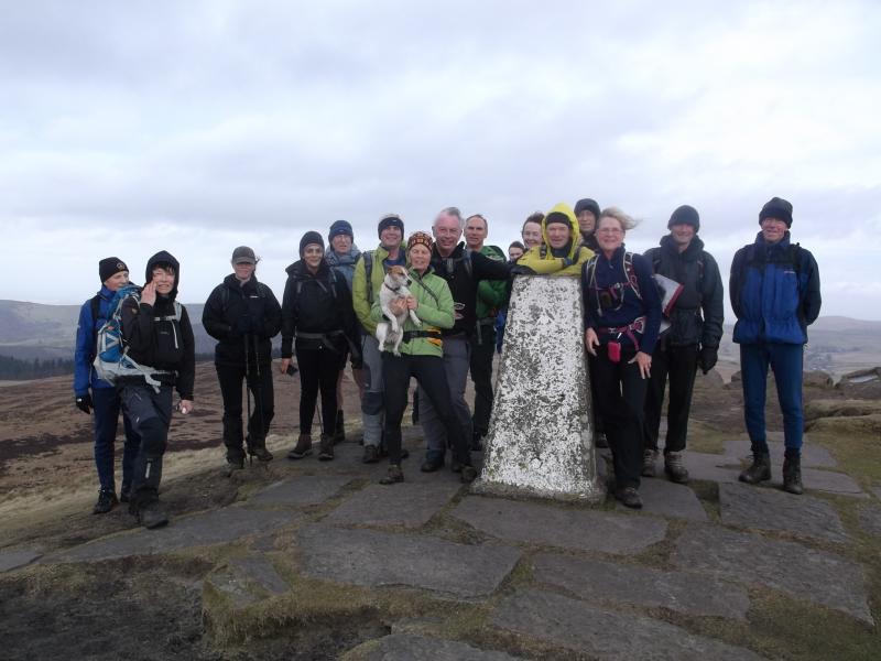
Eighteen people and Johnny (the dog) set off at 8.30 am from the Cat and Fiddle (second highest pub in England) and we briskly moved from Derbyshire soil (the cold wind had something to do with the pace), to head for Shutlingsloe 506m (the Cheshire Matterhorn). The route was via Chest Hollow, Clough Brook and Buxtors Hill. We approached the summit from Wildboarclough and went straight over and onwards to Macclesfield Forest where we picked up the Gritstone Trail and gasped up Teggs Nose 350m.......the ascent straight up the nose never gets any easier. Our next ridge was Kerridge 313m and White Nancy via Kerridge-end. White Nancy is a white hut shaped monument, more often than not tastefully painted to celebrate an occasion. (It was apparently named after one of the horses that carted the stone up the hill). We skirted the old cotton town of Bollington (Happy Valley) by dropping north and climbing to Sowcar and Spuley Lane to briefly re-join the Gritstone Trail. Onwards to the west of Andrew's Knob and our route could be seen clearly ahead along a ridge of Bakerstonedale Moor to Dale Top 384m, Sponds Hill 410m and finally Bakerstonedale Road. At Charles Head a recently opened concessionary path kept "our head in the clouds" for a mile and a bit to reach an old salt route (Yorkshire - Cheshire) at Bank Lane. A muddy descent bought us to Todd Brook, the border between Derbyshire and Cheshire, and we followed the brook to reach a lane near Saltersford Hall. However, we did have to step back into Derbyshire briefly to get to the lane. A short climb up the road and we contoured around Redmoor Brow on a delightful trod to enter the wide, open and remote valley known locally as Thursbitch. If anyone is a fan of the author Alan Garner, the ruins of Thirsbitch and the general locality of where we were will mean something to you, Seventeen people and a dog had never heard of him. A gentle climb out of the valley and almost home, "that extra bit of mustard" up Shining Tor 559m was taken in good stride. The return form here was on a good track to the east of Stake farm. As always, by the skin of my teeth we arrived back at the Cat for 5.15pm.
Many thanks to everyone for sharing the day and also for the kind comments at the end of the walk. We aim to please and yes it was a grand day out.
For those amongst us who don't have a GPS, the above description should be sufficient for you the trace the route on OS Epl 24 and 1.
Julie
Photos from Julie Spencer click here
From Steve: 


