Autumn blows in
Sunday October 29th. The Clarion House Way. 23 miles. Leader: Peter Smith.

Wednesday October 25th. A Loaf and Five Fishes. 15 miles. Leader: Norman Thomas
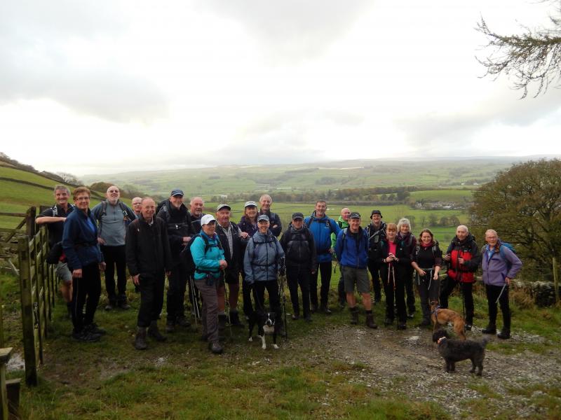
23 walkers took part today including 3 well behaved dogs. The weather was wonderful, a bit of a breeze but not a drop of rain. I decided to do the walk in the opposite direction, it made it a tougher walk I think.
We made our way through Upper Settle climbing for nearly 2 miles including Sugar Loaf Hill. It was very windy on top so we decided to have our morning break a little further on at the old second world war tank training range. Then onwards past Attermire Scar and Victoria Caves. We dropped down to the scenic Catrigg Waterfall in full force, I have never seen it in such a wonderful state. Down to Stainforth and then to Stainforth Foss, the river Ribble was too powerful to see the salmon leaping up although Viv saw one and Barbara saw two.
After lunch we made our way upwards towards Smearsett Scar but it was windy so we contoured round it. After this I decided to put a extra few miles into the walk in view of the wonderful weather and good company. We walked through some woods that in Spring have a lovely display of bluebells (people come from miles away to see them). Onwards to Feizer Hamlet and then we dropped down near to Settle and picked up the Ribble Way to walk into the town.
Well done everybody.
Thanking you, Norman
Pictures below from Paul.
Pictures below from Geoff.
Pictures below from Caroline.
3 pictures from Hilary before her camera battery gave out. Thanks to all the others who came to the rescue!
Wednesday October 18th. Whitworth Skyline. 13 miles. Leader: Peter Steckles.
21 walkers and three dogs set out from Healey Corner to sample the delights of the Whitworth Skyline - Clockwise. 200 yards later we stopped and waited for Norman and Chris who had been delayed by traffic on the motorway. And then we were 23!!! I thought Norman would be pleased...
Up the steps to join the disused Bacup Branch line, we turned and crossed the iconic Healey Dell viaduct over the River Spodden. Soon, after passing the site of Broadley Station we left the Bacup Branch line and passed up through the hamlet of Prickshaw. Climbing steadily, we joined Rooley Moor Road (formerly know as Rowley Moor Road) and more latterly known as Cotton Famine Road, because workers in Rochdale supported the American attempts to abolish slavery, themselves suffering badly. The workers themselves had to be supported by the Government of the day (possibly to stop rioting as the men could not feed their families) and so they were paid to cobble Catley Lane (as part of Rooley Moor Road was once known) and some of the work-creating projects included “…improvements in Catley Lane”.
A long and steady climb led to a small sink hole, where morning coffee was taken, and where Norman (who was late remember...) criticised the choice of venue as being 'not up to the usual standards of the East Lancs LDWA Group coffee stops... No pleasing some people...
As the air was getting decidedly nippy, (as we Brits are known to remark) we dropped down the track which led us into the magnificent Lee Quarry where the current owners, Lancashire County Council have set up a series of mountain bike trails and tracks. As well as providing mountain bike trails it offers an opportunity to understand the natural and industrial heritage of Rossendale. Parts of the site are classed as a Geological Site of Scientific Interest.
1887-1889 - 64 blocks of stone from Lee Quarries were used to build the four masonry pier foundations of the Eiffel Tower in Paris. I'm certain that Norman was aware of this, as I understand he had the contract for the plumbing on that job...
We wound our way through the quarry, passing the place where the walk leader fell from his bicycle in March 2017. Was there any sympathy...? No! most of the group laughed out loud (LOL to the younger members of the group...). Ah well.
We dropped down the tarmac to rejoin the Bacup Branch Line, and we took luncheon at Britannia in the car park with seating for all. The lunch stop venue was again questioned by Mr Thomas who said that the group were used to better lunch stops than on a main road next to a bus stop... There is no pleasing some people.
We were soon on the road again as it was getting even colder, so the climb up the oddly named Market Street through a couple of farms and finally up to the ridge which forms part of the Rossendale Way was welcome. Crossing the wobbly ladder stile, we noted a transistor radio wired to the fence, which was only able to be tuned in to receive Radio Lancashire, but sadly, not Radio Yorkshire. Sorry Ken. :)
The final part of the walk was described as Marble Rolling Terrain, but as we all know, descents that will propel a marble all the way back to the cars are merely a figment of Norman's fertile imagination, so we negotiated several waterlogged sections of moorland, and some less than efficient gates before arriving at the service road for the Crook Hill Wind Factory (11 Turbines). Here we took afternoon tea, but not before the indefatigable Norman criticised the venue (despite the shelter from the biting wind, and the many rustic seatings for the weary traveller, and his lateness at the start...) No pleasing some people.
We skirted Hades Hill and Brown Wardle (rather than going over them...) to pass Lobden Golf Clubhouse, rounding Rushy Hill before passing Healey Stones on our right. To avoid crossing the main Whitworth Road on the dangerous corner, we turned left just before Ending Rake, to cross the road more safely, and arrived back at the luxuriant toileting facilities at Healey Corner, where carriages awaited.
23 set off and 23 returned. An attrition rate of 0%. 13.7 miles according to Mr S Nav. We were blessed with the weather. A tad nippy in parts, but watery sunshine and no showers all day. Thanks to all who turned out - even Norman!!!
Peter (the lone diner at the Christmas Meal organised by Mr Thomas...)
Click here to see Peter's pictures.
How to climb a stile - the East Lancs way.
Sunday October 15th. Roundabout Ringheye. 18 miles. Leader: John Jocys.
An East Lancashire LDWA production…
Ringheye – the old name for Ringway, the site of Manchester Airport
This was my turn to lead a walk for the East Lancs LDWA. I’ve done very little with the LDWA over the last couple of years and the Roundabout Ringheye walk was my mea-culpa.
The weather forecast wasn’t brilliant: gloom followed by deeper gloom. At the least the gloom was forecast to be dry.
How wrong the forecasters were, we enjoyed warm sunshine virtually all day – I was more than glad I’d decided on wearing shorts.
The route was based on the ‘Jump in the Lake’ walk from a few years back – although there were some significant differences.
The walk coincided with the Manchester Half Marathon, held just a few miles north. Rather than setting off at bang on 9am we waited 5 minutes for any latecomers who may have been delayed by the road closures.
So, at 9.05am we wandered off, westwards, crossing the River Bollin and then following the very well-surfaced farm track to Ryecroft Farm, adjacent to the M56.
It was here that we turned South-West, crossing the M56 and following a mix of tarmac and footpaths to the very pretty village of Rostherne.
At Rostherne we followed a concessionary path (not marked on the OS map) that took us close by Rostherne Mere. This was as close as it’s possible to get to the mere, it’s situated in a nature reserve with very restricted access.
From Rostherne we headed directly to the Home Farm entrance of Tatton Park by way of the dead-straight church path.
This was a leisurely 18 miler so we stopped for a good 20 – 25 minutes at Tatton Hall….where they serve rather nice coffee and cake. Rather nicely expensive too.
Tatton Park was used extensively in WW2 for parachute training, the nearby RAF Ringway, now Manchester Airport, was home to No1 Parachute Training School. It only seemed right to include a visit to the training school’s monument, close to the landing zone in the park.
Long Suffering Rick and I had been at Tatton Hall on the previous Friday evening, playing a ceilidh. We’d notice signs warning of the rutting – deer might not take kindly to us marching past their love nests. Care was to be taken.
As it happened the deer were generally away from our route so there wasn’t a problem. Even for Alma.
Leaving the monument, we walked south, keeping to the western shore of Tatton Mere to exit the park at Knutsford.
A gentle wander through Knutsford, home to General Patton’s HQ in WW2, is always a pleasant experience.
Our lunch stop was in Knutsford’s park. Conveniently vacant benches overlooked the lake – filled with Canada Geese and other birdies.
Rick has been suffering from a poorly foot so he’d chosen this point to bale out. A train would whisk him backfrom Knutsford to Timperley in double-quick time. Rick went one way and we went t’other, north-east towards Mobberley.
This next section was made up of a mix of tarmac and soggy fields.
The Plan was to follow quiet lanes to the east of the airport rather than following the unofficial and clarty, slutchy footpath that runs (?) alongside Runway 2. A last-minute change of plan was made after a lengthy (about 20 seconds) discussion with Frank – we would follow the runway mudbath. This shortened the route slightly but had the advantages of a) testing the grippiness and waterproof qualities of our footwear, b) allowing us very good views of aircraft taking off.
Leaving the side of the runway we joined the Bollin Valley Way as it took us UNDER the runway and west-ish on the final leg of the walk.
The last couple of miles were very gentle indeed (they probably needed to be after visiting that trig-point), a pleasant riverside walk back into Hale and our cars.
We were done, dusted and finished by 4pm = a 7 hour bimble. We took 3 very leisurely breaks – this was a gentle 18 miler, not an eyeballs-out race. It was good.
Thanks to everyone who turned up, I hope you enjoyed it – I certainly did. I almost enjoyed Michael’s jokes….well maybe not.
18 miles / 960’ of ascent + lots of sunshine and laughs.
John
Click here to read John's blog and look at the pictures of the day.
Wednesday October 4th. Whalley and Beyond. 14 miles. Leaders: Dave and Alma Walsh.
Dave & Alma
Sunday October 1st. A Tower & Two Pikes. 17 miles. Leader: Ken Noble.
9 walkers left Todmorden on a damp Sunday morning to walk 17.2 miles around the hills and valleys of West Yorkshire with approx. 3,300ft of ascent.
The morning became brighter and revealed views across the valley to our second “Pike”, Stoodley, but by mid afternoon, the rain started and the wind picked up, true to the forecast that morning.
The first “Pike” is a war memorial on Smeakin hill near Peckett Well and the tower is the church tower at Heptonstall, where Michael showed us the location of Sylvia Plath's grave, American poet, novelist and short story writer who comitted suicide at age 30.
From Todmorden we had a long climb to Keelham Heights before descending Hippens Clough to Hippens Bridge.
We descended further, to the bridge near the chimney of Lower Lumb Mill before the ascent to Heptonstall and then to the wat memorial “Pike”.
After a few undulations, we descended to Hebden Bridge, only to climb to Stoodley Pike.
A steep descent brought us down to the Rochdale Canal which we followed back to Todmorden.
Ken.
Click here for Ken's pictures.
Click here for Steve's pictures.
Thank you to Barbara for the pictures below.


