HAWESWATER ROUND - 21.9.19
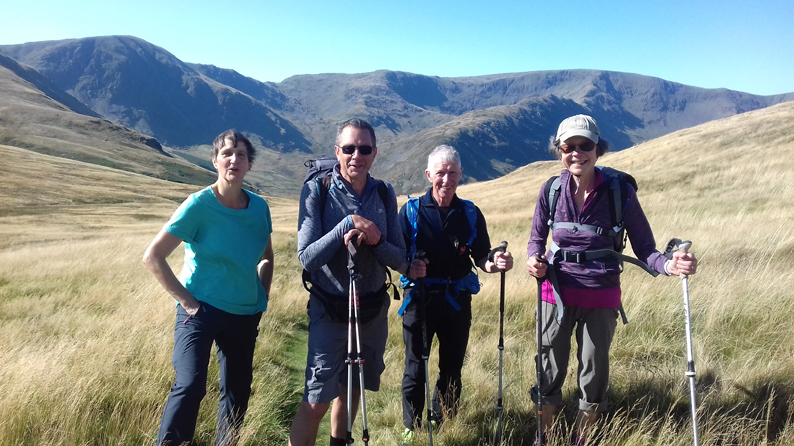
Five Cumbria LDWA regulars (Allan, Helen, Louise, Neil and Trish) met up in the parking area at Burnbanks (Grid Reference NY 508161) for an excellent walk around Haweswater in good sunny dry conditions.
Haweswater is a reservoir. Work to raise the height of the original natural lake was started in 1929. It was controversially dammed after the UK Parliament passed a Private Act giving Manchester Corporation permission to build the reservoir to supply drinking water to the city. The decision caused a public outcry because the farming villages of Measand and Mardale Green would be flooded, and the picturesque valley would be altered forever. The reservoir is now owned by United Utilities. It supplies about 25% of the North West's water supply.
The walk started on the Coast to Coast route out of Burnbanks through the woods to reach the road at Naddle Bridge then over the stile opposite to the winding permissive footpath on the south side of Haweswater Beck past Park Bridge, Highpark Buildings (stone barns) and Rawhead to reach the road from Bomby to Swindale. Turning right the walk continued to Swindale Foot, Truss Gap and Swindale Head passing on the way the waterworks at Grid Reference NY 523146. The inscription on the filter plant reads ‘West Ward R.D.C. Waterworks 1933’. West Ward is part of Cumbria so this plant must have been for local use.
From Swindale Head the route followed the Old Corpse Road reaching a height of 512 metres before dropping down to the road next to Haweswater Reservoir. The group turned left to reach Mardale Head after a further 1.8 km. The path round the southernmost part of the Reservoir was then taken with a welcome lunch stop on the rocks below Dudderwick. It was then back to Burnbanks along the west and north shores of Haweswater Reservoir passing The Rigg, Castle Crag, Whelter Knotts, Sandhill Knotts, The Forces (Waterfalls) and the Dam.
A magnificent day out enjoyed by all involved. The vital statistics were 21.3 km (13.3 miles), 753 metres (2,470 feet) of ascent and a total time of just over six hours.
|
|


