ROMAN RAMBLINGS - 11.3.17
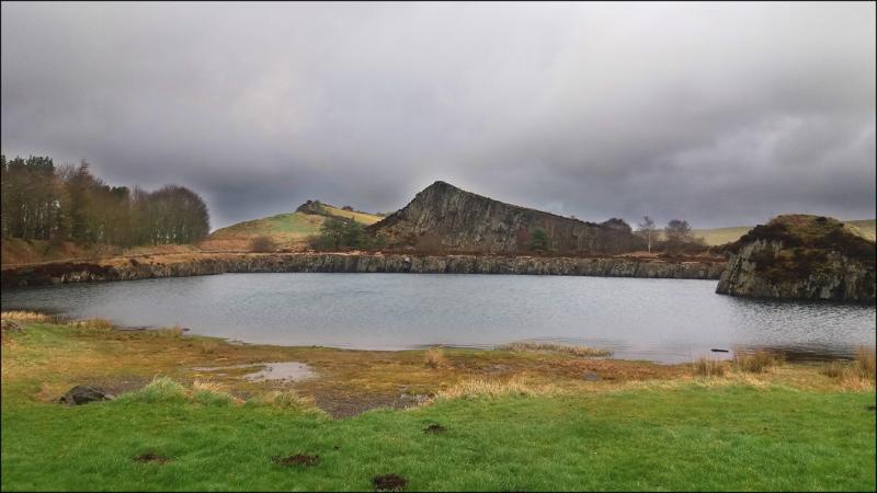
This walk could be defined by one word, MUD! An encouraging ten walkers arrived at Cawfields Quarry car park, including one guest, Alison, from Cleveland LDWA.
The route left Cawfields Quarry in a north easterly direction, passing Cawfields Farm and the three settlements at Close a Burns, where the muddy and boggy conditions were just a foretaste of what was to come. A short stretch of road walking took us to Edges Green, where we turned east, following a track to the remote farmstead of Wealside. Here the mudfest commenced! A soggy crossing of rough ground, characteristic of the area north of the wall, brought us to Gibbs Hill Farm. Having skirted the farm, our route continued north east on a track, which was a welcome relief from the mud, to Greenlee, a property on the edge of the immense Wark Forest and overlooking Greenlee Lough.
The National Park bird hide on the lough shore provided an excellent coffee stop; although access wasn’t ideal, with mud and bog aplenty in the vicinity of the hide!
Rain showers came and went throughout the morning and as we left the hide a shower had started. Continuing east, we passed the settlements of East and West Stonefolds and soon met the Pennine Way before it entered Wark Forest. Turning south on the Pennine Way we passed through three small valleys between Greenlee and Broomlee Loughs. Hadrian’s Wall was now in sight. The view of the wall from the north is one that few tourists will see, the majority visiting it from the south. The Dolerite cliffs, which are part of the Great Whin Sill form the ‘back’ of the wall. It is easy to see how the Roman Army took advantage of this lofty landscape. After a short climb to Rapshaw Gap, we were able to take in the view of our morning’s route. We turned east, briefly following the line of the wall and passed through the Housesteads site. Our route then continued south on a tarmac track down to the Military Road, the northern section of the walk now behind us.
Having crossed the Military Road, we continued south past East Crindledykes Farm to the Haltwhistle Road, where we turned west. The section of road walking which eventually took us to the Vindolanda site, was punctuated by a break for lunch. The Crindledykes lime kiln provided an acceptable stopping point. The lime kiln is well preserved and was one of c. 300 which were operational in Northumberland in the 19th century. Beyond Vindolanda, further road walking with a short dog-leg took us to Cranberry Brow track, from where we could look across to the Tyne Valley. Moorland paths, offering views of the profile of Cawfields Quarry, brought us to the Military Road at the Milecastle Inn, from where it was only a short distance to the Cawfields car park.


