


RDs and GPX files
Last updated 23 May 2018
Public Access to the Duke of York's Royal Military School (DOYRMS), Dover - The Finish HQ for the Cinque Ports 100
As the weather and daylight improve entrants will no doubt start conducting recces of the 100 route which finishes at DOYRMS. The 100 route enters through the front of the school and continues on to the school site to reach the Finish. However, if anyone recces the route before the 100 event and arrives at the school, please do not try to enter the school site. DOYRMS is a boarding school and does not allow public access at any time, unless authorised. The school has a security barrier and a security guard at the front gate to control access to the site. For the same reason please do not attempt to park in the school; it is better to park in Guston at the rear of the school if you want to have a car waiting for you at the end of a recce.
If you have any queries about the above, please contact John Elrick, the Finish HQ Co-ordinator, on jandaelrick@btinternet.com
Public Transport
Walkers proposing to reconnoitre the route in stages may find this forum thread helpful in planning public transport.
Risk Assessment
21 February 2018: The current version of the Risk Assessment for the event is here.
29 April: Google maps of hospitals and their contact details in East Sussex and Kent.
29 April: Google maps of chemists and their contact details in East Sussex and Kent.
30 April: Google maps of filling stations in East Sussex and Kent.
29 April: This Defibrillator Locator Map requires your postcode. In addition, all Kent Fire Stations now have public access defibrillators - read this News Release.
13 May: Map, addresses and locations of local Hospitals and Defibrillators.
These FINAL versions of the route are now available for the Main Event:
17 May 2018: Route Description v1.50 (PDF) Route Description v1.50 (Word)
Following the Marshals' Walk, the RDs have been further checked and updated. A couple of paragraphs have been subdivided.
The emergency phone number for the Main Event is now included.
Any further changes will be made available here on a separate amendment sheet.
23 May 2018: RD amendment (PDF) RD amendment (Word)
GPX v1.50 matches the latest Route Description - one file covers the entire route.
Checkpoint Data provides information about each checkpoint.
You can use PACER to follow entrants' progress and results during the event.
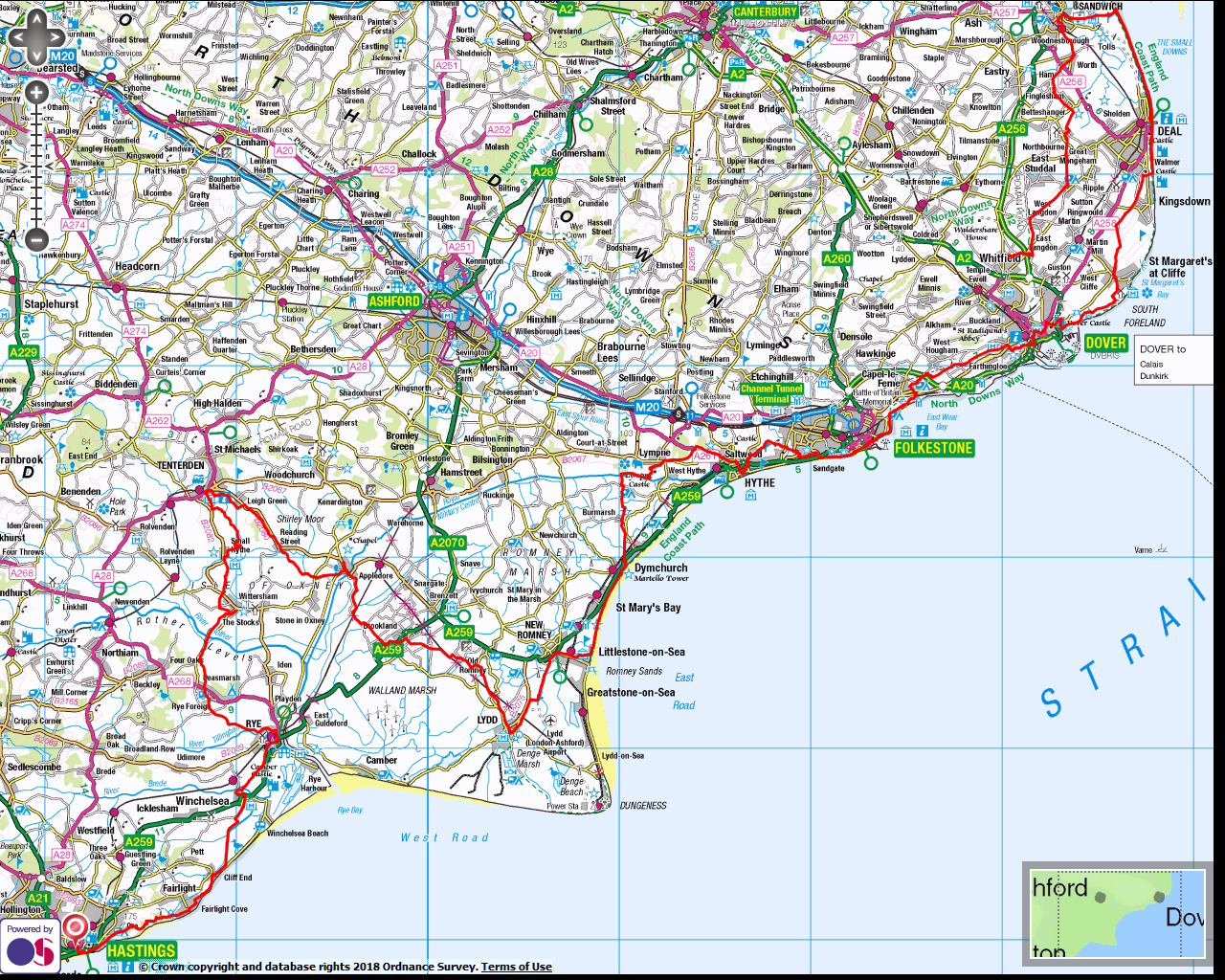
The Route in Context (PNG) displays a road map with the route superimposed.
Menus - what to expect at each checkpoint.
And a reminder - these are the Rules.
These FINAL versions of the route are now available for the Marshals' Walk:
25 April 2018: Route Description v1.41 (PDF) Route Description v1.41 (Word)
The RDs have been further checked and updated. A few paragraphs have been subdivided.
The emergency phone number for the Marshals' Walk is now included.
GPX v1.20 remains unchanged - one file covers the entire route.
Checkpoint Data provides information about each checkpoint.
You can use PACER to follow entrants' progress and results during the event.
The Route in Context (PNG) displays a road map with the route superimposed.
Menus - what to expect at each checkpoint.
And a reminder - these are the Rules.


