

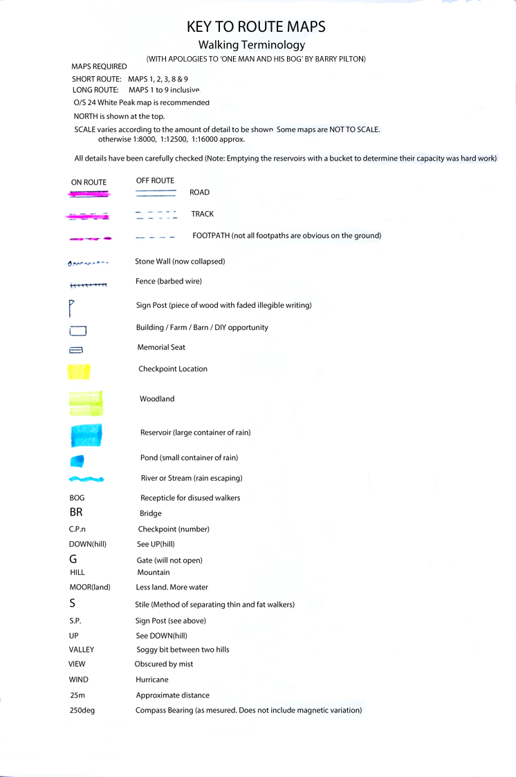
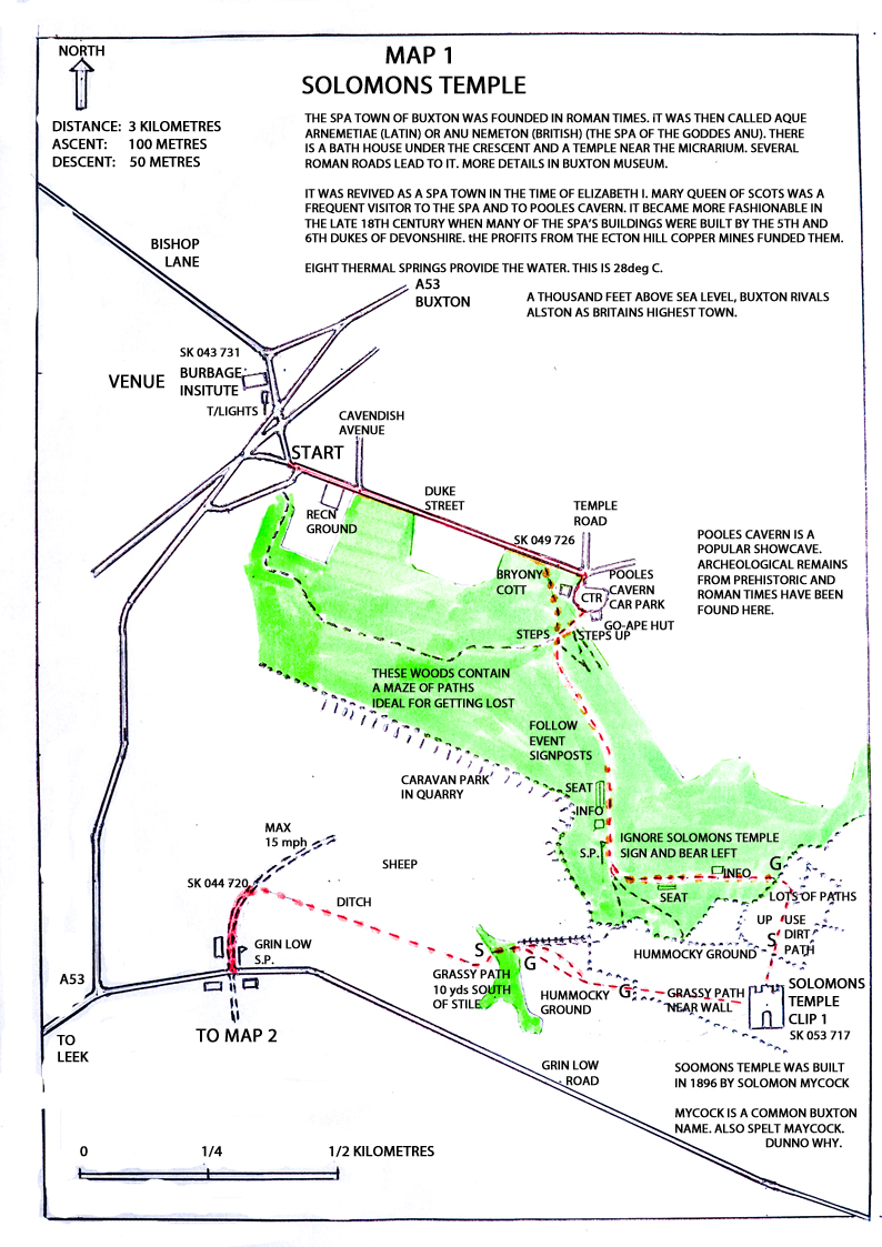
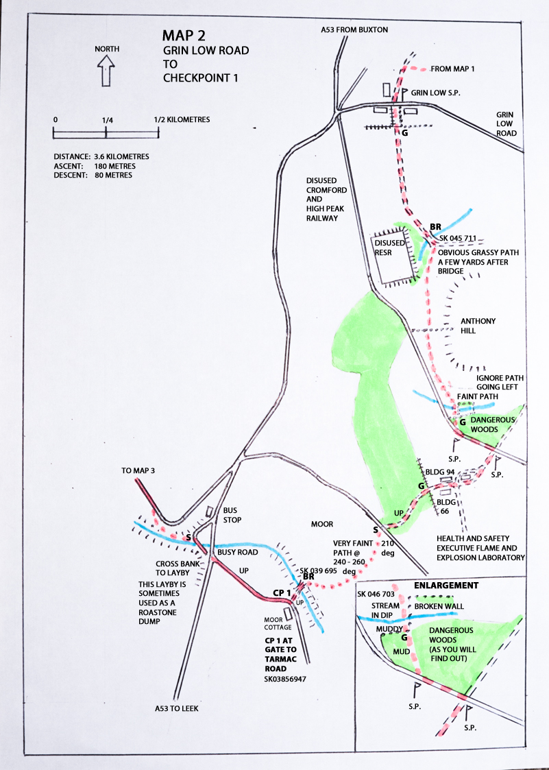
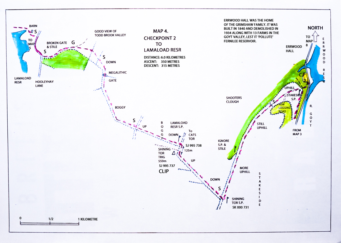
Route maps
The Goyt Valley Challenge. Route Maps
No change to routes for 2017.
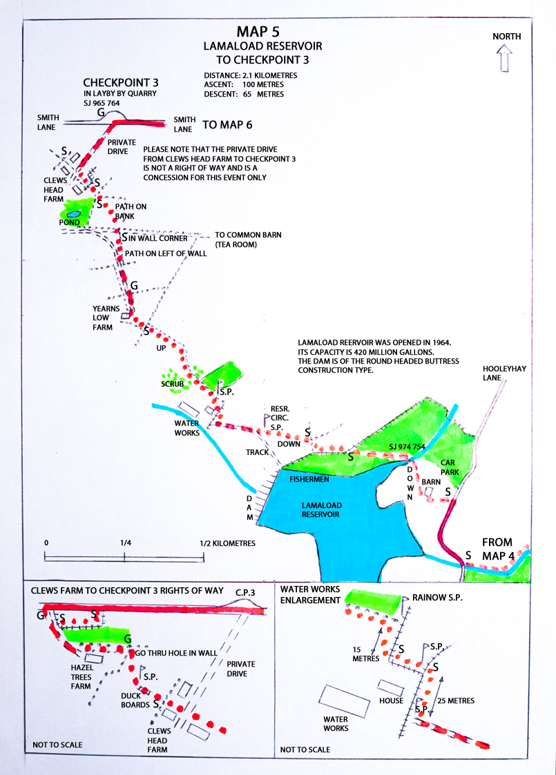
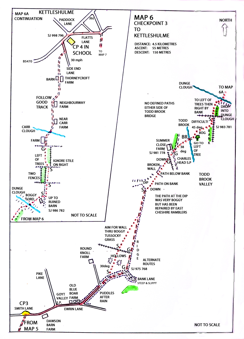
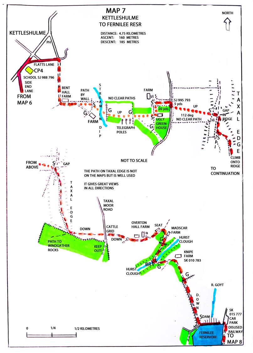
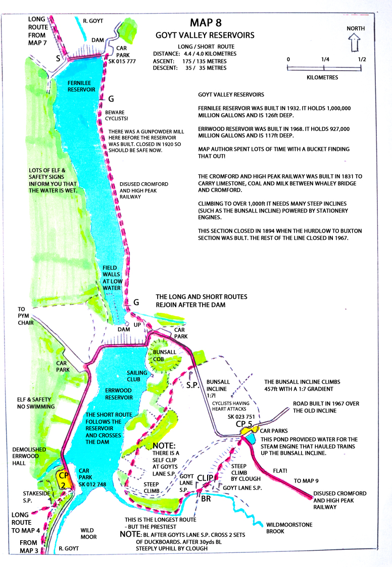
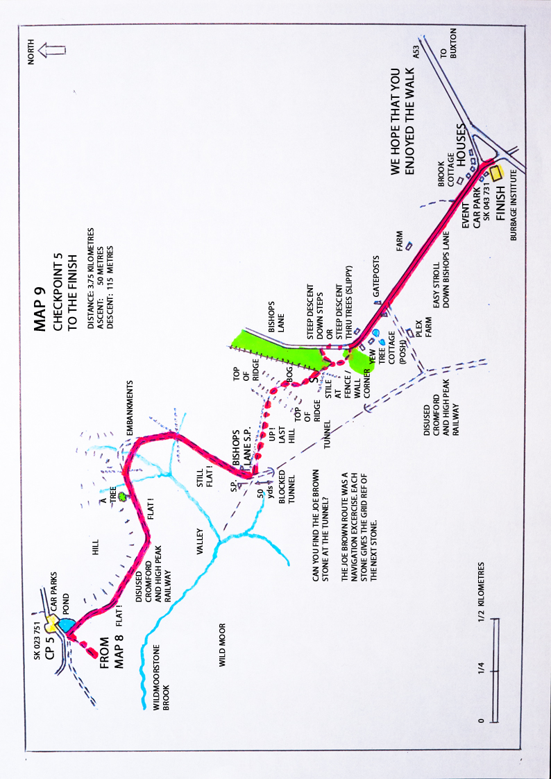
Coloured 'Strip' type route maps are provided for this event instead of route descriptions.
The long route requires all maps.
The short route requires maps 1, 2, 3, 8 and 9.
They are hand drawn and photgraphed. Apologies for one or two technical problems in doing this.
They provide more precise route information than O/S maps and correct some of their inaccuracies.
The route can easily be transfered to O/S maps. They include historic and other information about the route.
Click on the links to display the maps. These can be printed.
MAP_8_Goyt_Valley_Reservoirs.jpg
This links to a gpx. file of the route:
Goyt_Valley_Challenge_Long_Route_-_2016.gpx
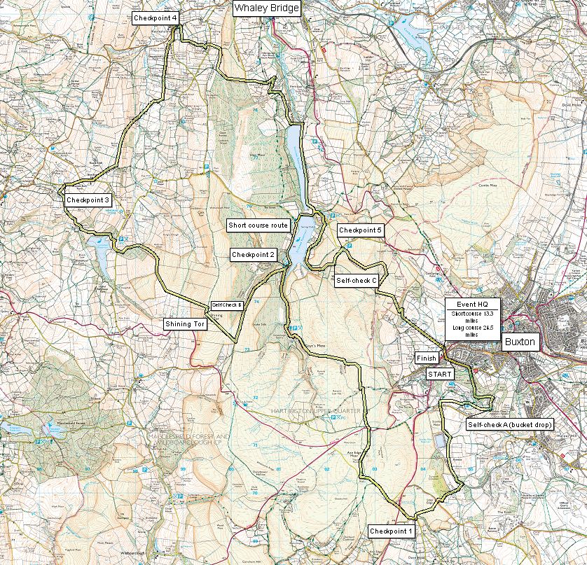
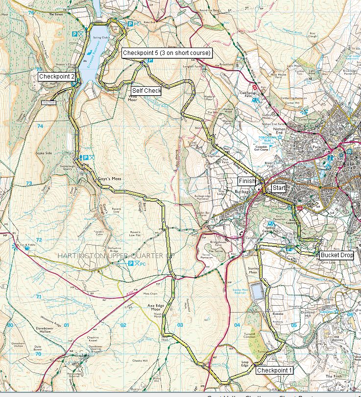
Tracklog overviews of the routes (not printable):
Goyt_Valley_Overview_Long_Route_-_2016.jpg
Goyt_Valley_Overview_Short_Route_-_2016.jpg
Printed Route Descriptions
Short_Route_Description_Final.docx


