
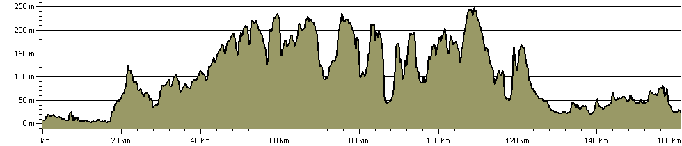
Elevation Profile
The route elevation profile is below, with the route statistics.
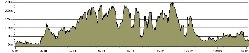
160.6Km (100.4 miles)
2,993 m (9,820 ft) ascent
251 m (823 ft) maximum height.
The profile may be downloaded below for a better quality picture:
Page version information: No updates. Added 10 June 2012.


